Rezoning
West side of South Virginia Street, west of intersection with Towne Drive and northwest of intersection with Rhodes Road, Reno, NV
5/ 5
Prime signal
Bedrock impact score
Action type
Rezoning
Asset class
Multi-asset · site-wide
Status
On municipal record
Filed
2026-08-12
Jurisdiction
Reno, NV
Days on record
17 days
 Approx — jurisdiction center
01Investment highlights
Why this deal matters
- Rezoning in Reno, NV
- Bedrock impact score 5 of 5 — Prime signal
- A 161-acre industrial/rural parcel on a major Reno corridor is being unlocked for neighborhood commercial development
- A rare large-scale entitlement opportunity that resets land basis and opens the door for retail, mixed-use, or pad site plays on South Virginia Street.
- On the municipal record 17 days (filed 2026-08-12)
02Deal summary
The rationale
A 161-acre industrial/rural parcel on a major Reno corridor is being unlocked for neighborhood commercial development — a rare large-scale entitlement opportunity that resets land basis and opens the door for retail, mixed-use, or pad site plays on South Virginia Street.
Reno City Council is adopting an ordinance (Bill No. 7338, Case No. LDC26-00039) to rezone a ±161.2-acre site on the west side of South Virginia Street from UT-40 and Industrial designations to a mix of Neighborhood Commercial (±39.3 ac), Parks (±87.2 ac), and other categories, as part of a Master Plan Amendment and Zoning Map Amendment for the Ladera Properties project.
03Deal facts
The filing record
- Jurisdiction
- Reno, NV
- Action type
- Rezoning
- Asset class
- Multi-asset · site-wide
- Applicant
- Ladera Properties
- Status
- On municipal record
- Filed
- 2026-08-12
- Days on record
- 17 days
04Location
Where this sits
West side of South Virginia Street, west of intersection with Towne Drive and northwest of intersection with Rhodes Road, Reno, NV
39.54910, -119.84990 · approximate (jurisdiction center)
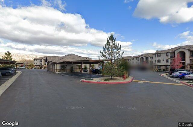
Street view
At street level
Area demographics
Washoe County
464,182
Population
$68,272
Median HH income
186,116
Households
$1,028
Median rent
U.S. Census · ACS 5-year
Nearby amenities
Within ~1 mile
6 Schools
6 Dining
1 Banks
5 Parks
Points of interest · Google Places
05Record timeline
Filing to current status
- Filed with jurisdiction2026-08-1217 days on record
- Scored by BedrockRelevance 5 / 5Automated land-use signal
Similar properties
More in Reno, NV
5Plan amendmentEast side of Kietzke Lane, north of East Peckham Lane, west of Interstate 580, ±875 feet south of East Moana Lane, Reno, NV5PermitEast side of Kietzke Lane, Reno, NV5RezoningNorth side of Moraine Way, ±160 feet west of North Virginia Street, Reno, NV5RezoningMoraine Way (north side, ±160 feet west of North Virginia Street), Reno, NV