Rezoning
470 Olive Avenue, Palo Alto, CA
5/ 5
Prime signal
Bedrock impact score
Action type
Rezoning
Asset class
Multi-asset · site-wide
Status
On municipal record
Filed
2026-09-09
Jurisdiction
Palo Alto, CA
Days on record
Not dated


01Investment highlights
Why this deal matters
- Rezoning in Palo Alto, CA
- Bedrock impact score 5 of 5 — Prime signal
- A single-family parcel in the North Ventura corridor is being upzoned to Medium Density Mixed Use and folded into the Housing Inventory
- Opening the door to higher-density residential or mixed-use development on a newly entitled site adjacent to El Camino Real.
02Deal summary
The rationale
A single-family parcel in the North Ventura corridor is being upzoned to Medium Density Mixed Use and folded into the Housing Inventory — opening the door to higher-density residential or mixed-use development on a newly entitled site adjacent to El Camino Real.
Palo Alto City Council is holding a public hearing to adopt an ordinance rezoning 470 Olive Avenue from NV-R1 (Single-Family Residential) to NV-MXM (Medium Density Mixed Use), amending the North Ventura Coordinated Area Plan (NVCAP) land use designation from Low Density Residential to Medium Density Mixed Use, aligning the parcel with the adjacent 2951 El Camino Real and adding it to the City's Housing Inventory.
03Deal facts
The filing record
- Jurisdiction
- Palo Alto, CA
- Action type
- Rezoning
- Asset class
- Multi-asset · site-wide
- Parcel · APN
- 25PLN-00228
- Status
- On municipal record
- Filed
- 2026-09-09
- Days on record
- Not dated
04Location
Where this sits
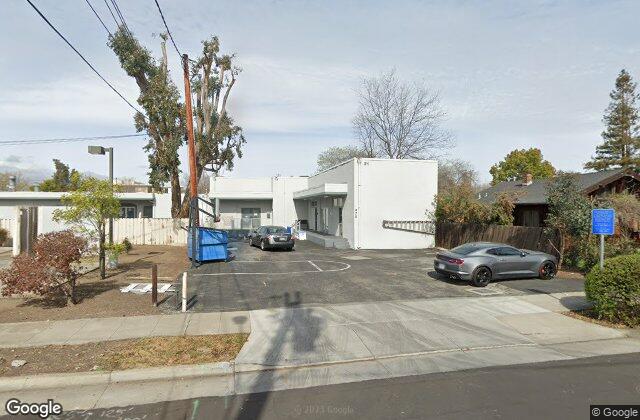
470 Olive Avenue, Palo Alto, CA
37.42272, -122.13994
Street view
At street level
Property record
Parcel & ownership
- APN / Parcel
- 13237029
Parcel data · Santa Clara County
Area demographics
Santa Clara County
1,924,379
Population
$130,890
Median HH income
635,314
Households
$2,271
Median rent
U.S. Census · ACS 5-year
Nearby amenities
Within ~1 mile
20 Transit
20 Schools
20 Dining
3 Grocery
9 Banks
18 Parks
Points of interest · Google Places
05Record timeline
Filing to current status
- Filed with jurisdiction2026-09-09On the municipal record
- Scored by BedrockRelevance 5 / 5Automated land-use signal
Similar properties